TAUM SAUK MOUNTAIN STATE PARK
The Most Beautiful Spot on the Ozark Trail
Taum Sauk Mountain State Park has trails that guide you through some of the most beautiful sections of the Ozark Trail. The large parking lot accommodates many vehicles, but you may want to arrive early during high-traffic Summer weekends.
The Road to the Top of the Mountain
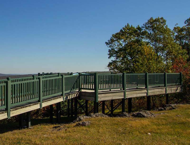
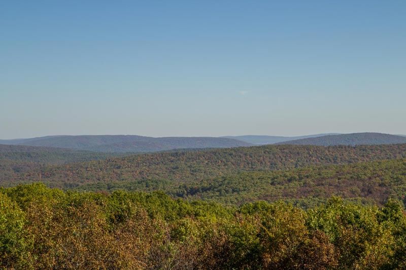
The road to the top of the mountain turns to gravel near the top, but it is just a short hike from the parking lot. There you will find an overlook which treats visitors with views of miles of rolling, Missouri countryside. A little further past the overlook is the Taum Sauk trailhead where the real adventure begins. This 35-mile long Taum Sauk section of the Ozark Trail guides hikers through the ancient St. Francois Mountains, some of the oldest mountains in the United States.
Beautiful and Rugged Taum Sauk Mountain
Between Taum Sauk and Johnson Shut-Ins
The 14.5 miles between Taum Sauk State Park and Johnson Shut-Ins State Park is the most popular and pristine section of the Taum Sauk Area. This rugged portion of the trail is best for average to more experienced hikers and requires good directional skills. The trails are marked with color coding, allowing hikers to navigate the terrain comfortably. Bring water on this trek as there are no places where water is readily available to drink.
Access to Amazing Geological Features
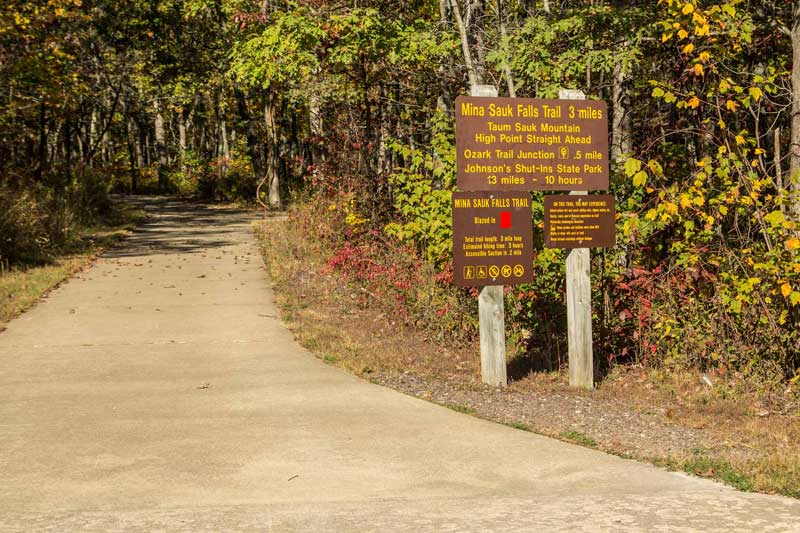
The Taum Sauk hike begins with the Mina Sauk Trail, a 3-mile trail that leads hikers to two of Missouri’s most exciting geological features. A wheelchair accessible trail leads to the top of the Taum Sauk Mountain which is the highest point in the state at 1,772 feet above sea level. Be sure to take some time to enjoy the beautiful views of scenic Missouri.
The Mina Sauk Trail
Mina Sauk Trail is a strenuous hike, so be prepared for rugged terrain and rocky cliffs. Again, bring plenty of water to avoid dehydration while hiking in warmer weather. There are climbing
obstacles, rugged naturally surfaced trails, shifting rocks, steep inclines, bluffs, drop-offs, and water crossings on this trail. The estimated hiking time for this 3-mile trail is about 3 hours and is
outlined in red for directional purposes. From the Mina Sauk trail, hikers can access the Taum Sauk Section of the Ozark Trail where the trails run together for about a mile. Mina Sauk trail loops back up the mountain as the Ozark Trail continues through the rocky, rugged terrain.
The Tallest Waterfall in Missouri
Follow the rugged trail down across the top of Mina Sauk Falls to see the tallest waterfall in Missouri. This wet-weather waterfall flows 132 feet down rocky steps into Taum Sauk Creek and is best viewed after a heavy rain.
Begin Your Adventure Here
Take off on this epic adventure. Begin at Ironton, Missouri. From Ironton, MO, head east on Russell Street toward S Knob Street for 0.2 miles. Turn Right onto MO-21 S and follow it for 4.9 miles. Take a Left onto State Highway CC. After 3.8 miles, turn Left onto High Point Trail Head. In 453 feet, you will arrive at Taum Sauk Mountain on your right.
On Top of the Taum Sauk